Friday, August 29, 2008

August 27, 2008: Harbor Island, Michigan


Today we are on schedule to meet our kids in Michigan, and crossed into the United States of America at Drummond Island. It was really a moment of patriotic pride at the sight of the American flag flying over the Drummond Island Yacht Haven marina. I had missed Ole Glory and had a warm satisfaction with being HOME.

There we met the US customs officers in their navy blue shirts and shorts who came out to the boat to check our credentials and log our reentry into the country. Tom had done a wonderful job have having the right documentation to make the encounter a very pleasant one.


Tonight we are anchoring out in a small cove near Drummond Island. We are in the lee of Harbor Island which is a US Wildlife refuge and in an anchorage which the guide book said was often filled with as many as 30 boats. But tonight there are just two of us so the view is mostly of nature. There is a beautiful light green band of marsh grass that circles most of the shore skirting the dark green spruce and cedar tree woods. You could hear the whisper of the wind rustling through the grass, and it was very relaxing. We took a swim in the waning warmth of the sun and saw were a few brown ducks cruising in the grass looking for dinner. Our dinner for this evening will be our white fish from Killarney and sun brewed tea from the back deck.

August 26, 2008: Blind River, Ontario


Today we moved the boat to the most northern point of our entire trip. Blind River, a little town on the northern shore of Lake Huron was originally founded as a lumber town with a saw mill set up on the falls of the river. The old lumber mill site was right where we pulled into the marina, and there was still a huge stack of logs there. There was also a Museum to the Lumberjacks that Tom and I saw on our bike ride around the small town. We found a modern grocery store there and restocked our milk, bread, and Coke Zero, the important staples.

There was a nice three pier marina with many sailboats in residence. The marina had a community turbine windmill to produce electricity, which ran whenever the wind speed exceeded 15 miles an hour. They also had a large marine store which had a greater supply of snow mobiles than boating equipment. Apparently there is an ice bridge from here across Lake Huron to Michigan when the lake freezes solid.


Tonight we had an unexpected luxury. We could pick up American television, and got the local Michigan weather and news. We are almost home.

Tuesday, August 26, 2008

August 25, 2008: Benjamin Islands, North Channel, Ontario


Today was a very unusual day because we are in the same place tonight that we were this morning – a whole day of not being underway. Many people have told us that this is the most beautiful spot in the North Channel, so we decided we were taking a break. After my morning calls, we took the dinghy to shore and found a narrow inlet between two big boulders to be our mooring spot. There we enjoyed a short hike or climb up the boulders trying to reach the top of a stone peak just off our stern.

There was no path this time, and when it got to be lunch time, I decided I had enough hiking. I felt a little like a mountain goat. It has been interesting to watch the big sailboats come and go from the anchorage and see dinghies scooting around.

This afternoon, in the warm sunshine, we swam across the clear cool water and reached the smooth stone shelf that stretched down into the water. The rock was very warm and a great place to hang out. So it has been a very lazy day of just drinking in the beauty of God’s earth.

Monday, August 25, 2008

August 24, 2008 (Sunday): Kagawong to the Bengamin Islands

Sunday was a backward day for us because we had discovered that the United Church on the Hill had their worship service in the afternoon. So Sunday morning, we set out in bathing suits and bug spray to find the Bridal Veil Falls. On the way, we passed the old limestone mill at the end of Kagawong River. This was a mill built in 1925 that produced the pulp to be shipped to Michigan to make paper for the Sears and Roebuck catalogs. Tom that was a significant link to our southern history and needed to be recorded here. It was later a hydroelectric plant, and now a community center.

The trail to falls led by the creek below the falls, and reminded us of a walk through Montreat below the Lake Susan dam in the western part of NC. The creek was singing a happy gurgle and churning the sparkling clear water over and around the rock strewn bed. The banks were often overhung by evergreens trees and wild flowers. The falls were a pretty sight with the water falling maybe 40 feet into the pool below. In our bathing suits, Tom and I walked the rock ledge behind the falls getting wet with the spray, but decided the bed of the pool was to rough to swim there. It was fun to see the falls up close and personal before drying our feet and heading back to the marina. At the marina (already in damp bathing suits), we took a swim off the sandy beach and took advantage of the big yellow sliding board out in the water.

After lunch, we climbed back up the long hill to attend the worship service at the tiny church on the hill. . Several people greeted us and welcomed us to their church. They had a old upright well tuned piano that made lovely music with amazing acoustics in the small sanctuary. They had a lay meditation on forgiveness, and we enjoyed singing Amazing Grace. They had beautiful wooden pews which were obviously crafted specifically for this room because of the angle that the side pews made with the aisle was reflected in the angle of the armrest. The church was the oldest building in the area dating back to 1881 and they had a huge embroidered quilt of the wall from their centennial celebration in 1982 (OK, so they were a year off).


This afternoon, we set off into the windy bay to anchor out for the evening in the Benjamin Islands. We were glad to find a still anchorage in the midst of the massive granite outcroppings of the Canadian shelf. It was fairly stressful in the wind and Tom tried a new trick of tying the stern to a tree on the shore. Unfortunately, in trying to dock the dinghy, he lost the long rope to the water; but a friendly boater zipped over to the back of our boat and got the line and ferried it back to shore for us. After making sure we were secure, we took our dinghy back over to the rock edge and trekked up the smooth warm pink and gray face to sit and enjoy the wonderful view. The sight was post card perfect of the cove and blue green water we are sharing with several other boats. The closing night of the Olympics all we got on TV was sound, no picture,... oh, well, we are ready for football season to start.

Saturday, August 23, 2008

August 23, 2008: Kagawong, Manitoulin Island


We pulled out of Little Current just as the deluge began. We had spent the morning cleaning the boat, Tom the outside, and me the inside, to warm sunshine and a steady breeze. Tonight we planned to make it to Kagawong because there is a church there. The water was gray and choppy as we proceeded up the North Channel and there was lightening flashing in the distance. It rained so hard that the water streamed into the upper deck around the canvass top and isinglass windows which were all zipped up tight. Tom switched the chart plotter to the radar, and just like an airline pilot, recalculated our route to avoid the “dark green” on the screen as best he could. We arrived in Kagawong with it still raining and were glad to have a couple of dock hands come out to help us tie up at the Tag-a-long Marina.

When it finally stopped raining, we took a walk around town and discovered that this little village has a very unusual public park. The first thing we came to was a huge paved game board, where you would walk around to move your checker board pieces. Next there as a maze created by a forest of 6 foot tall cedar bushes/trees where you entered by a gate and then tried to reach the pole in the center. There were obvious places where players had cheated by creating unofficial holes in the hedge, but it was fun to find the right way all the way in and all the way out. Next we came to a maze which was laid out with stones on the ground so that you could see your friends as you played. It looked like a great place to play with a four year old grandchild.

Kagawong was settled first as a timber town with a sawmill built in 1873. Kagawong is a Ojibwe word which is translated to mean “where the mists rise from falling waters” and is a reference to the Bridal Veil Falls on the Kagawong River near by on a hiking trail from the city park. We will try to find them tomorrow.


Friday, August 22, 2008

August 22, 2008: Little Current, Manituolin Island


This morning we decided to take the suggestion of climbing up the granite mountain to see the beautiful views of the bay. We took our dinghy over to a low place on the shore, and found the steep path lined with pine needles along the stones. Part of the way was very much like climbing a ladder, where you had to be careful of your footing and were looking for handholds to keep you steady. I admit that I had to have a couple of breaks on the way up, but it was fun to reach the top and see The Next Thirty Years as a miniature below in the water. We crossed the rocky top, and could see Killarney bay in the distance.

We found an interesting green marker approaching Goat Island. There were two green lights on the shore one set back some distance from the other so that when one was above the other, you were approaching the inlet in the channel. We saw the markers as we arrived at Harbor Vue marina to retrieve our propeller which we had delivered there. The Manituolin Bridge, Highway 6, which was built in 1914 as a railway bridge only opened on the hour. So at 1:00, we crossed under the swing bridge which is the only bridge connecting Manituolin Island to the mainland, into Little Current. Little Current is the largest community on the island and was originally settled as a lumbering center. After the lumber was depleted, it became a fishing community. Now it is mostly a tourist yachting center except for the fish farming in the area. Tom and I have been amazed to see some very expensive sailboats at the city docks that were chartered, so you can come and go sailing without bringing your own boat.

Tonight we are at Spider Island marina tied up at the end of the fuel dock, where we have washed clothes and had a nice walk to dinner to the Anchor Inn, the only restaurant open in town.

Thursday, August 21, 2008

August 21, 2008: Killarney, Ontario


Today we left the Georgia Bay and turned into the North Channel running alongside the Manitoulin Island towards Mackinaw City. So when we turned down the channel to Killarney, the first thing we encountered was a tug pushing a wide metal barge loaded with a tractor trailer fuel truck. As we neared the city wharf, he waved that he was trying to park where we were, so we circled out of his way and we watched while he turned so the truck could drive off over a ramp way, and then tied up to the dock. I am always interested to see people who are living their daily work routine on the water. I can honestly say that I have never seen a fuel truck on a barge before.
We docked there in Killarney to have lunch at Herbert Fisheries which is a fish and chips place serving up lunch boxes from the side of a red and white school bus in front of the fish market. While we were sitting at a picnic table on the wharf eating what the Canadians call "white fish", fried and crispy along with fries, we got to see their fishing boat come in. The boat was very different than what I was used to, because it was totally closed in. They docked at a low section of the wharf, so they could step out of the side door and they unloaded large crates packed with white fish and trout that they had just caught this morning. I commented to one of the sailors about our NC fishing boats and their wings to hold the nets, to which he explained that they did not troll for the fish like in NC. They were setting gill nets in the afternoon and then coming back the next morning, pulling the nets in with a winch, and hauling all those fish back to the fish market. They were filleting fish on a working table in the back of the boat then carrying them into the fish market where they were cut up for frying for lunch (talk about fresh fish), or shrink wrapped for sale or shipping. It was a fun experience, and it reminded me of the history of Tony’s Sanitary Fish Market in Morehead City, which started out as a fish market that cooked fish and served it on the dock. The advantage Tony’s has is that the waterway it sits on is not frozen for months of the year. We did buy a white fish for our freezer so we can have it again.

Tonight we are anchored in Covered Portage bay, a hidden lake with a tiny finger of water leading back out to the channel. There are nine other boats sharing the space, but there is plenty of room. We are surrounded by rocky cliffs of jagged granite and one of the other boaters told us that you could climb to the top. I guess we’ll try that tomorrow.

Wednesday, August 20, 2008

August 20, 2008: Strawberry Island


Today we cruised through an amazingly calm version of the Georgia Bay with rippling glossy water stretching out to the horizon. It is hard to imagine a large body of water any smoother. Random white puffy clouds hover just above the horizon. This is how it must have looked when the natives crossed in their canoes to reach Beausoleil Island. Our anchorage for tonight is Strawberry Island

The highlight of today was our trip to a restaurant which Tom found in a tour guide book that was supposed to be “in the vicinity”. We could have found it easily using our electronic chart plotter, but Tom wanted to go by dinghy. So while I worked this afternoon, he made a scouting trip to find it. Returning 2.5 hours later, he assured me that he had found the Georgian Bay Fishing Camp and thought he could find it again.

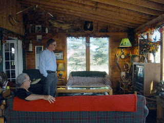
So we left at 5:00 PM for a wandering path through a maze of stone fingers, some above water and some visible not far from the surface under the clear water. We passed a quaint red roofed lighthouse maintained by the Canadian Park system. And sure enough, by 6:00 PM we were nearing a old silvered dock surrounded by old red metal fishing skiffs. The Georgian Bay Fishing Camp, a group of weathered white sided building with red metal roofs, is over a century old and sort of like a fishing boarding house. We shared our dinner table with another looper, James, from Louisiana and two very talkative business men from Toronto. Oddly, the Fish Camp was serving spaghetti for dinner! The sitting room where we ate was walled with honey colored pine paneling and had an amazing glass coffee table built around a sculpture of a 3 foot muskie about to make a meal of a smaller fish . In the corner, there was a large moose skull with antlers under a fish mounting on the wall. They had several of the Muskogee chairs we have fallen in love with and an interesting wire window hanging, saying “Welome to the lake!” The food was OK, and it was certainly a memorial experience visiting there.

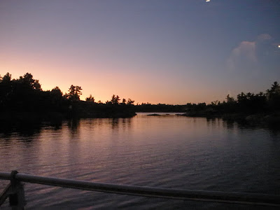
The trip back was cooler, and we were glad for the water to be fairly calm. Back at the boat, anchored by Strawberry Island, we saw a glorious orange sunset in the sky and reflected in the still water. Our antennae TV once again is picking up the Olympics and even in an English speaking channel.

August 19, 2008: Shawanaga Island, Georgia Bay

Echo Bay was a beautiful little nook where we anchored in a side channel by a bevy of nice sailboats. Check us out on YouTube at: Echo Bay

This morning we started out for Sans Souci which had a city dock offered by the Chamber of Commerce. This extensive floating city dock system, with power stanchions and drinkable water faucets, was surprisingly virtually empty. Everyone says that the Canadian boating has been seriously impacted by the cost of fuel. We tied up there for a couple of hours and Tom went to the grocery store while I took several work conference calls. We also got a free tank of clean water before heading off for another night “on the hook”.

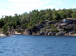
In the afternoon, we traveled to “the hole in the wall”, a place where there is a natural channel 80 feet deep between two high rock walls. Since the channel is narrow, it was hard to find riding along. Someone had gone to the trouble to paint a huge white smiley face on the ridge above the entrance to help other boaters find it.

Later we cruised around Shawanaga Island which offers many narrow cubbyholes, inlets in from the water. We found a small beautiful sheltered area totally surrounded by little stone islands; we are in Hopewell Bay without a boat or cottage in sight. The entrance to this area was marked by a little inuksuit man and his companion dog, artistically crafted with stacked stones on one of these small islands - such a quaint marker.

We took a quick swim tonight up to the Shawanaga stone shelf which extended out into the clear water. We crawled like alligators up onto the stone from 4 foot deep water and laid in the sun for a few minutes. (Sorry, no pictures because the camera was in the boat). There was a primitive fire ring higher on the rock that campers had created. The experience was genuine assimilation of the Canadian rock shelf and the geological forces that were at work to create the islands. I did find a small rough sample of pink feldspair to bring home as a souvenir. Since the mosquitoes were finding us, we returned to the boat to cook barbequed chicken for supper.